Sticky logo
 Search

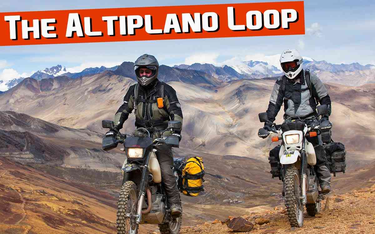
Bolivia is an adventure rider’s paradise. From the Amazon to the Altiplano, every mile is a feast for the senses.
Four lanes of graded dirt are interrupted only by the occasional dozed-up barrier… a small deterrent along this unfinished thoroughfare for anyone hoping to cheat the rougher backroad route to Salar de Uyuni in southwestern Bolivia. A late model Toyota Land Cruiser clings precariously by its bumpers to a pair of bridge buttresses, connecting the void on this apocalyptic highway.
Its windshield hangs impaled on rebar some 20 feet downrange. I trip the latch and am surprised to find the deck-lid unlocked. The radio is missing, but the vehicle is otherwise intact. No blood… incredible. It occurs to me that vigilance is an adventure rider’s best friend.
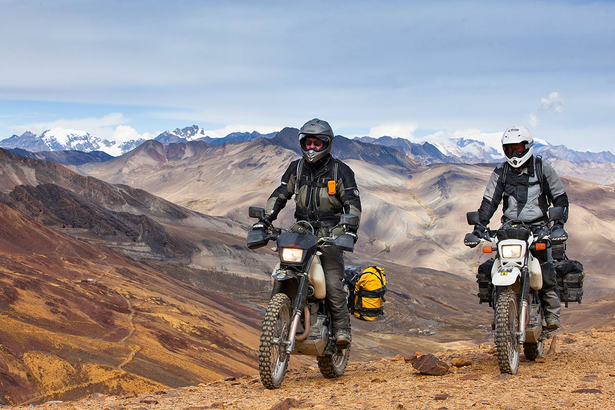
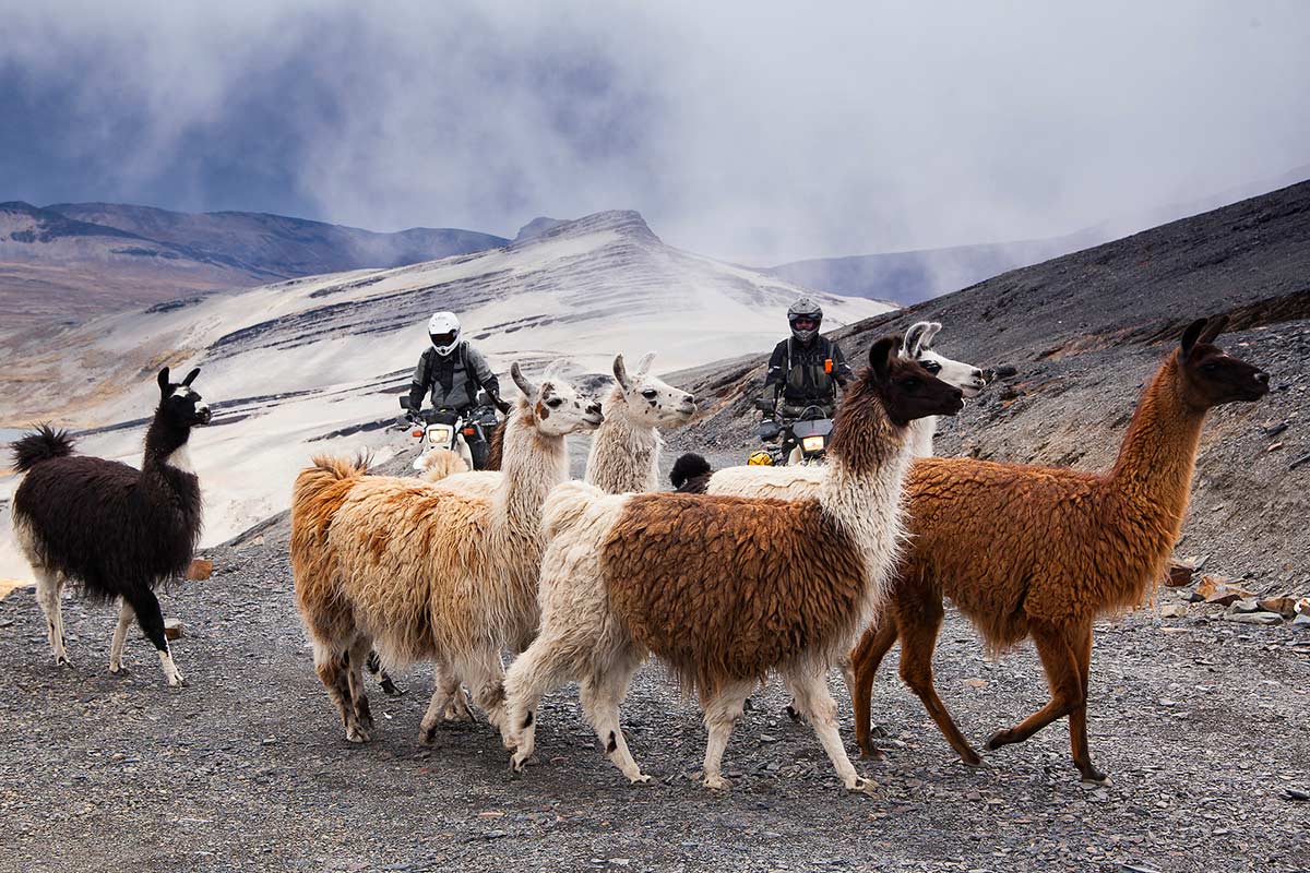
We are well into our exploration of the Altiplano, that high plain flanked on the east by the rain forests of the Amazon and on the west by the Atacama Desert, one of Earth’s driest spots. Our week-long dual sport ride out of La Paz is giving us a taste of the history and diversity of this land and a sample of the dirt roads and mountain trails that make this place such a paradise for the adventure rider.
I am riding with Eric Hougen of Wolfman Luggage. The Wolfman spent his formative years in Bolivia, attending grade school in La Paz, the country’s seat of government. Our hosts are Sergio Ballivian, one of Eric’s classmates and owner of Explore Bolivia, and Oscar Ebert, Sergio’s right hand man. We had just skirted a quarter of the world’s largest salt plain, the Salar de Uyuni, on our Suzuki DR 650s, finishing at night.
I had read stories of riders closing their eyes while blazing across this 4,000-square-mile table of white at full throttle, and had seen the distorted proportions captured by creative photo compositions on this outdoor studio some 25 times the size of Utah’s Bonneville Salt Flats. We made our own memories riding three abreast, the countless crystal geometric formations crunching beneath our tires in a staccato beat.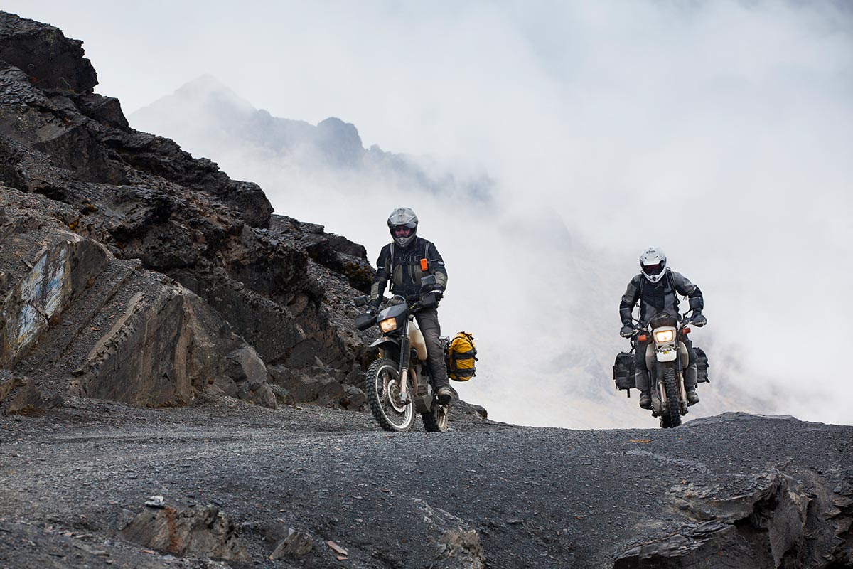
Before starting our loop, a warm-up ride took us north out of La Paz, over 15,000-foot La Cumbre Pass in a winter mix to The Death Road. Our first view was a thin line of dirt below, belting the lush Yungas Valley where Highway 6 links La Paz to the Amazon. Until recently, this was the only route between La Paz and the resort town of Coroico. Trucks, busses and bicycles were forced together on the serpentine path clinging to the canyon wall like a tree snake basking in the sun.
Drivers would run the gauntlet past slides, inert vehicles, and waterfalls cascading like an eternal, isolated rain shower. Before the paved route was built across the valley it was practically a daily occurrence that some unfortunate soul would die playing chicken, however inadvertently, with oncoming traffic. Now, with an alternate route taking the brunt of business, we enjoyed the infamous Camino de las Yungas nearly devoid of rolling obstacles.
Entering Coroico at dusk, we were met by a sign, “Welcome to Paradise.” Next morning when we saw our surroundings in daylight we understood the sign’s meaning. Coca fields, orchids and other fragrant jungle flowers surround the village and permeate the senses.
Our lodging, the Ecolodge Sol Y Luna, lay among them. Weekenders come here to escape the trappings of the city and relax, lured through the subtropical Cloud Forest by cobblestone pathways. Nearby Cotapata National Park, with its waterfalls and remote canopied hideaways, removes all doubt that this place really is a piece of paradise.
We returned to La Paz to regroup before the main event. As we set out again, Eric and I pushed the pace through the La Paz Valley, railing the dusty double track while Sergio and Oscar followed along, keeping tabs on our progress. When traveling abroad it is wise to partner with locals. Routes, road conditions, even the availability of fuel can be sketchy, especially in the more remote regions of South America. We were fortunate to have Sergio and Oscar as our guides.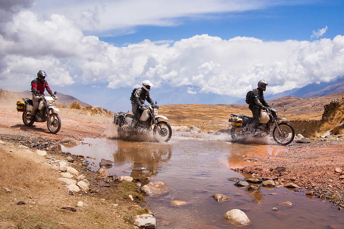
Evening faded black before we could reach Araca, where we would spend the night. We rode side by side on precarious double track to beat the dust. Tiny pinpricks of light began to appear as we neared the village. Our approach to the Hacienda Teneria was like something out of a movie. A narrow, dark and rocky road led us to a closed gate.
We expected bandits to jump out at any minute, but were greeted instead by a small boy who opened the gate and disappeared into a building whose foundations were laid before the pilgrims landed at Plymouth Rock. Hans Hesse, our host and grandfather to the gatekeeper, was a fascinating mix of historian, engineer and philosopher. He entertained us throughout the evening with locally discovered artifacts and stories of ancient Phoenicians he believes may have a place in his ancestry.
The next morning, before starting our climb out of the Choqueyapu River canyon, we had to gas the bikes. Oscar stood atop his Nissan Patrol and siphoned petrol from a battery of containers, our lifeline to civilization as we moved farther from the mechanized world. We passed groups of schoolchildren along the way and a mother tending sheep, her baby strapped to her back. I had never witnessed pigs being herded before… never thought it possible, having grown up with many failed attempts.
But, we passed Cholas, indigenous women in stacked skirts and bowler hats, successfully managing groups of swine and keeping them all going in one direction, more or less. Our next night was spent in the green valley and village of Luribay after an incredible climb and descent over desolate, rutted and rock-strewn roads leading to the Altiplano.
Even a lumpy bed and shocking, electric showerhead couldn’t hinder a good night’s sleep. Climbing again the next morning, 21,000-foot Mount Illimani stood over us as we made our way south and west.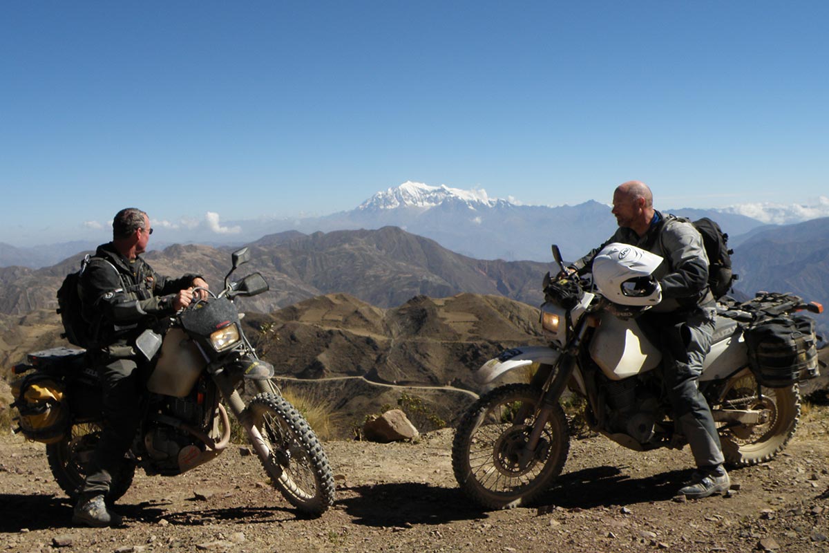
We left the dirt roads and scampered down the paved and bustling Pan American Highway to Potosi, once considered the richest city in the world. It is a long day’s ride and we welcomed the more comfortable, “big city” accommodations once we arrived. Silver was discovered in Potosi during the Spanish rule in 1544 and Potosi Mountain is still active with more than 16,000 miners pushing ore cars in and out of 500-plus tunnels.
A mine tour made us grateful for another line of work.Cracked timbers shored up crumbling rock overhead and temperatures reached 100 degrees F deep within the mine. We chewed coca leaves to ward off the effects of activity at 14,000 feet and brought a supply of the narcotic plant as gifts for the miners along with soft drinks and water.
From the narrow, crowded streets of Potosi, we rode cobblestone roads the short distance to the Hacienda Cayara, tucked into a corner of the village of Cayara, which hides in a valley in the rugged Andean foothills.
This magnificent family home-turned-guesthouse contains museum-quality colonial antiques. It is said to be the oldest country hacienda on the continent, dating back more than four centuries. Original paintings from the 16th century adorn the walls and were enjoyed by generations of nobility.
Priceless artwork, furniture and libraries dating back to the 17th century can be touched by the guests who stay there even now. We drank from the centuries-old, eternal fountain out back and bathed in a nearby hot springs where Inca kings once came to escape the rigors of royal duties.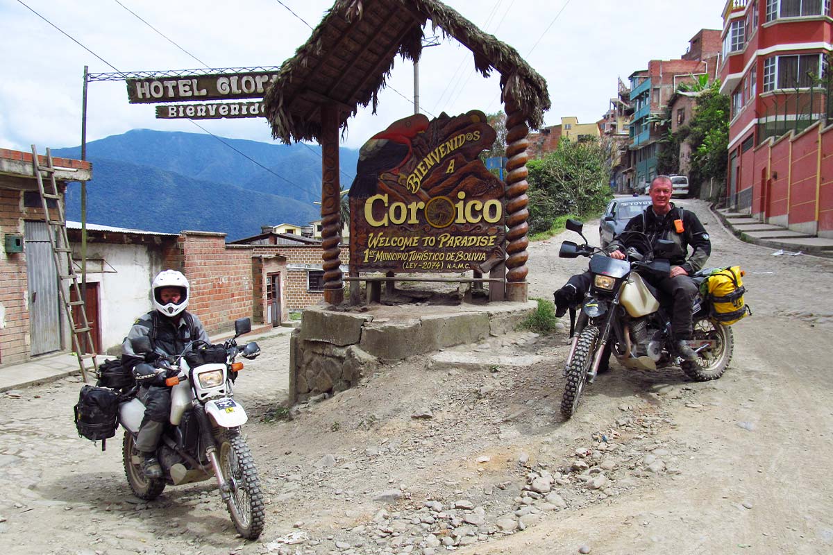
We were reluctant to trade the Hacienda Cayara for the dusty streets of Uyuni, but didn’t want to miss the magnificent Salar de Uyuni. We chased the sunset to Fish Island, the only land promontory in the Salar, stopping there long enough to appreciate the uniqueness of this desert oasis, complete with Saguaro cactus, simple accommodations, and a small diner for refugees from the outside world.
Darkness was upon us as we left Fish Island—if riding across this endless crystalline expanse during daylight seemed extraordinary, doing it at night was indescribable. We quickly became chilled since we hadn’t stopped to don our warmest layers, but the sensation only added to the edge as the starlit scene moved in slow motion even as we rode full speed on our mounts.
Our senses were hyperactive. Fear melded with excitement until they were indistinguishable from one another.
It was like a dream when we finally left the salt plains for the narrow streets of Jirira, at the base of the volcano, Tunupa. We encountered the Land Cruiser bridge as we exited the Salar and before continuing to the mining town of Oruro, the final stop of our Altiplano loop. We met resistance there when trying to purchase fuel, but managed to find a good meal and a comfortable bed before returning to La Paz.
No adventure ride would be complete without a little drama. Ours came in the form of a road block by indigenous Indians who had placed stones across the highway about 20 miles outside La Paz. We were faced with taking the long way around through miles of deep silt or trying to breach the blockade… not a wise choice given the conviction of the locals to protest new infrastructure.
We chose the longer, safer route and avoided an altercation. Even paradise needs a dash of adversity or we couldn’t call it adventure!
Check out Wolfman motorcycle luggage at: WolfmanLuggage.com
And, learn more about Explore Bolivia at: ExploreBolivia.com